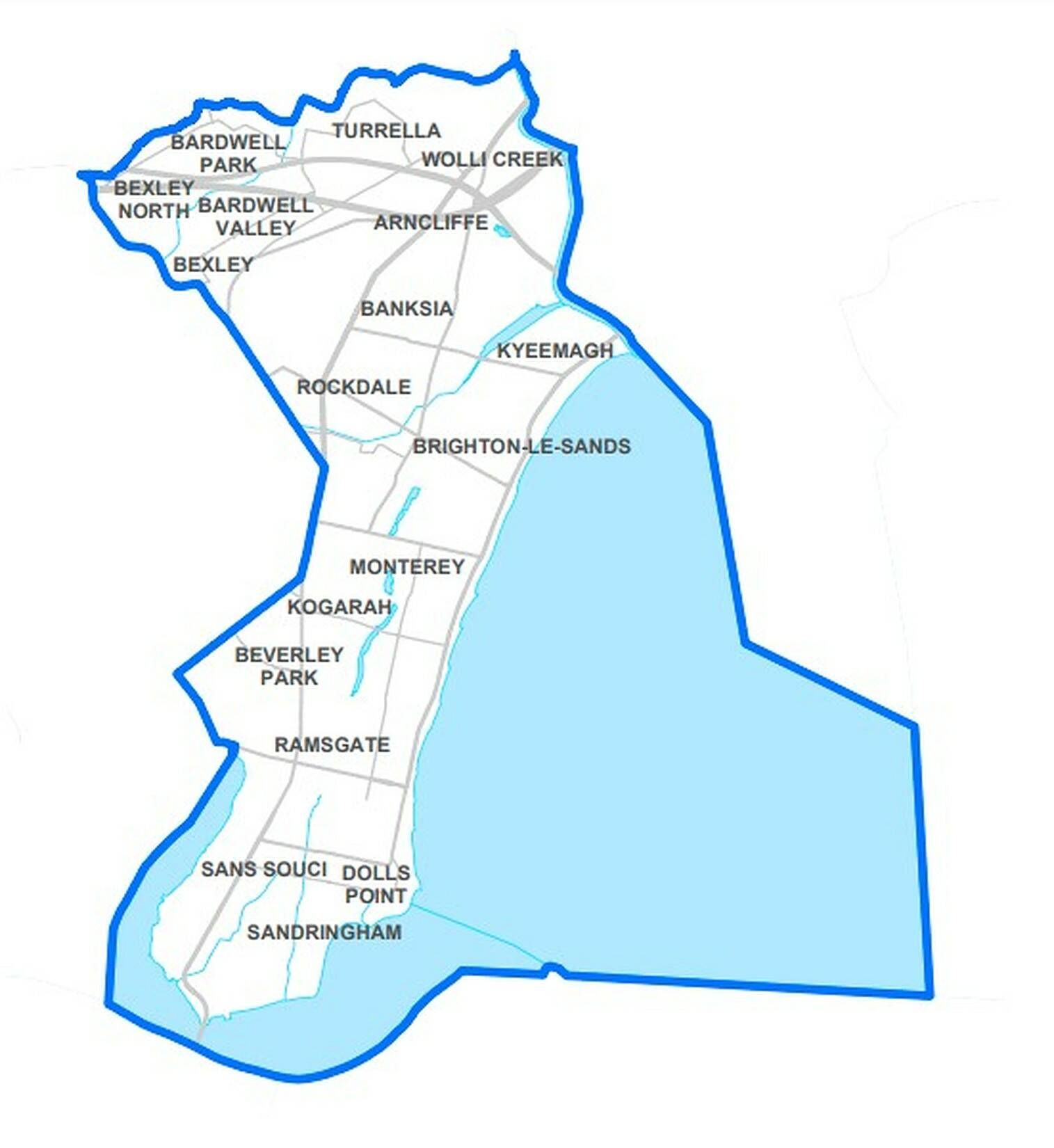
The Electorate of Rockdale is based on the western shore of Botany Bay and stretches between the Georges River to the South and the Cook's river to the north. In the easterly direction, the electorate covers everything between botany bay and the princess highway up until the suburb of Rockdale itself, where it breaks north-east to instead following Harrow Road and Bexley Road up until it reaches the m8 train line along Wolli Creek.
The Electorate of Rockdale currently takes in the suburbs of Arncliffe, Banksia, Bardwell Park, Bardwell Valley, Beverley Park, Brighton-Le-Sands, Dolls Point, Kyeemagh, Monterey, Ramsgate, Ramsgate Beach, Rockdale, Sandringham, Sans Souci, Turrella, Wolli Creek, the parts of Kogarah on the eastern side of the Princess Highway, and the parts of Bexley and Bexley North that are north of Harrow and Bexley Road.
The Electorate also used to include Kogarah Bay however it was moved to the neighbouring electorate of Kogarah in the 2023 Redistribution.
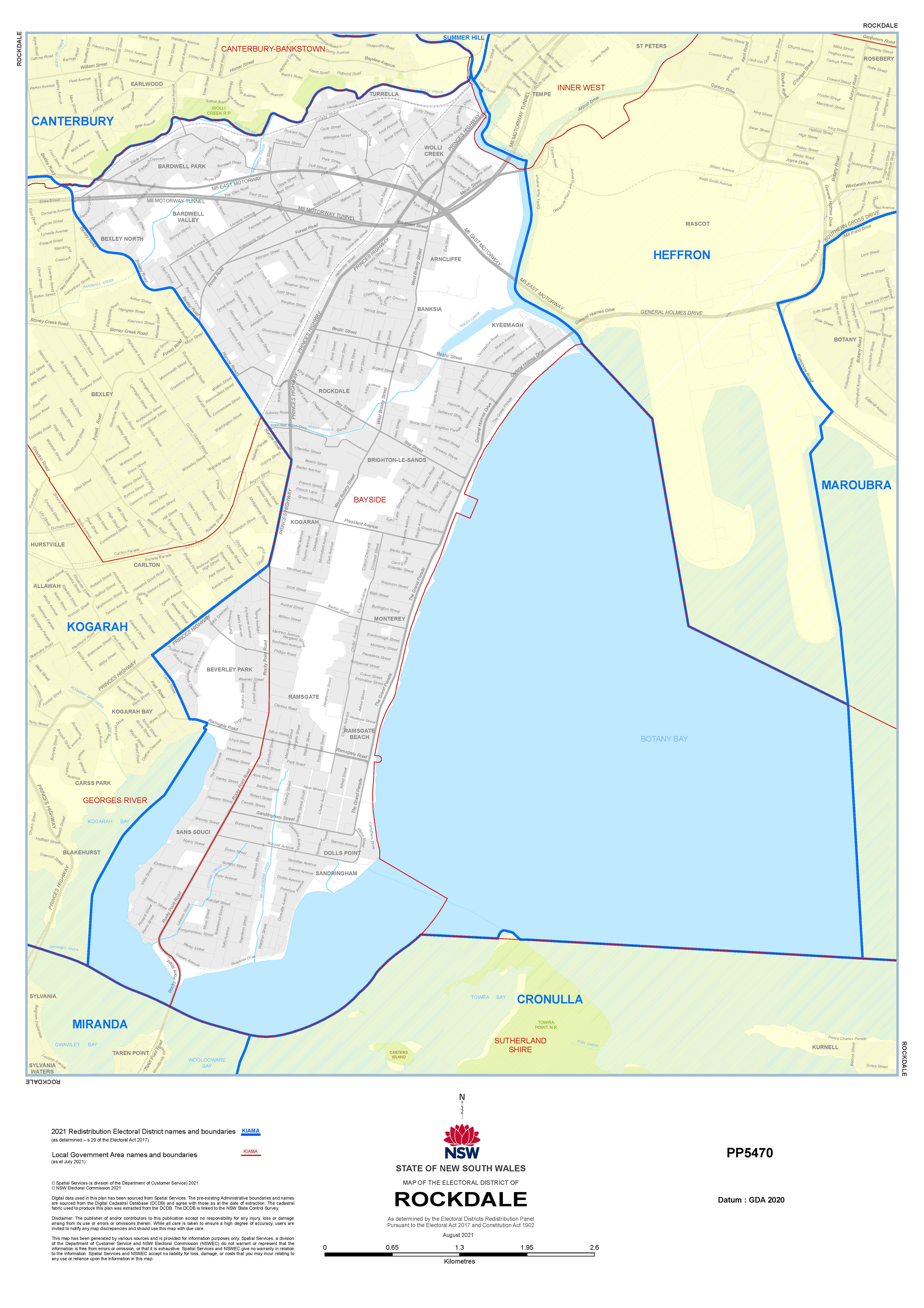
The Electorate in nearly entirely contained within the Bayside Local Government area, encompassing the entirety of Bayside wards 3 (Based around Bardwell Vally and Rockdale) and 5 (Based around Brighton and Sans Souci) as well as significant chucks of wards 2 (Wolli Creek and Mascot) and 4 (Bexley and Kingsgrove).
However, there are still parts of the Rockdale Electorate that overlap with Georges River Council, notably the suburb of Beverly Park and the parts of Sans Souci to the western side of Rocky Point Road, which are contained within the Kogarah Bay ward of Georges River Council.
On the Federal Level, the state Electorate of Rockdale overlaps with three federal Seats, Cook to the south in Sans Souci, Sandringham, and Dolls Point, Kingsford-Smith in the east along Botany Bay, including Kyeemagh, Brighton, and Monterey, while the rest of the electorate, including Rockdale, Wolli Creek, Arncliffe, Bexley, Beverley Park and Ramsgate is contained within the seat of Barton.
Steve has served as Rockdale's MP since 2015, and is the 7th Member for Rockdale since the seat's establishment in 1941.